Tuesday 23 June 2015

Today...A recce of the route...

Doggedly determined Bella with Pete in Mosedale.


There's a place to park at the head of the valley in Mosedale, but not knowing this, Pete and Bella left the car in Mosedale village and walked the three kilometres up the valley. Anyway it was supposed to be a work-out, a get fit session, as well as a recce of part of Day 4 of the Cumbrian Way Walk which starts next Tuesday and it was certainly that!

I wanted to find a track that rises from the valley of the River Caldew towards Knott, there's one marked on the 25,000 map at NY314313 which leads up the blunt ridge of Cocklakes towards Comb Height and I thought it was a good idea to explore its possibilities.


Mosedale in June

Mosedale means the valley of the peat bog and there are several Mosedales in the Lake District, however this one is probably the most attractive of them, it is a delightful place in June and I was glad I'd left the car far behind.


River Caldew looking West


When approaching from the W the track in question starts up the fellside in a northerly direction 200m after the Blackhazel Beck joins the Caldew from the SE. The track was clearly not subject to a great deal of useage but was quite distinct and was a useful and rapid way up the fellside which would otherwise have meant slow progress in tussocky grass and knee-high heather. The track gave out at about 560m just as the slope eased before reaching the plateau of which Comb Height is marked on the map as the high point at 627m. An increasingly intermittent path led N to a better one which led from Comb Height towards Knott about 1.5km to the WNW.


Comb Height 627m looking towards Knott in the distance centre

 Though dwarfed by mighty Skiddaw to the SW , Knott at 710m is the high point of the surrounding Caldbeck and Uldale Fells and the highest point of the walk on Day 4.


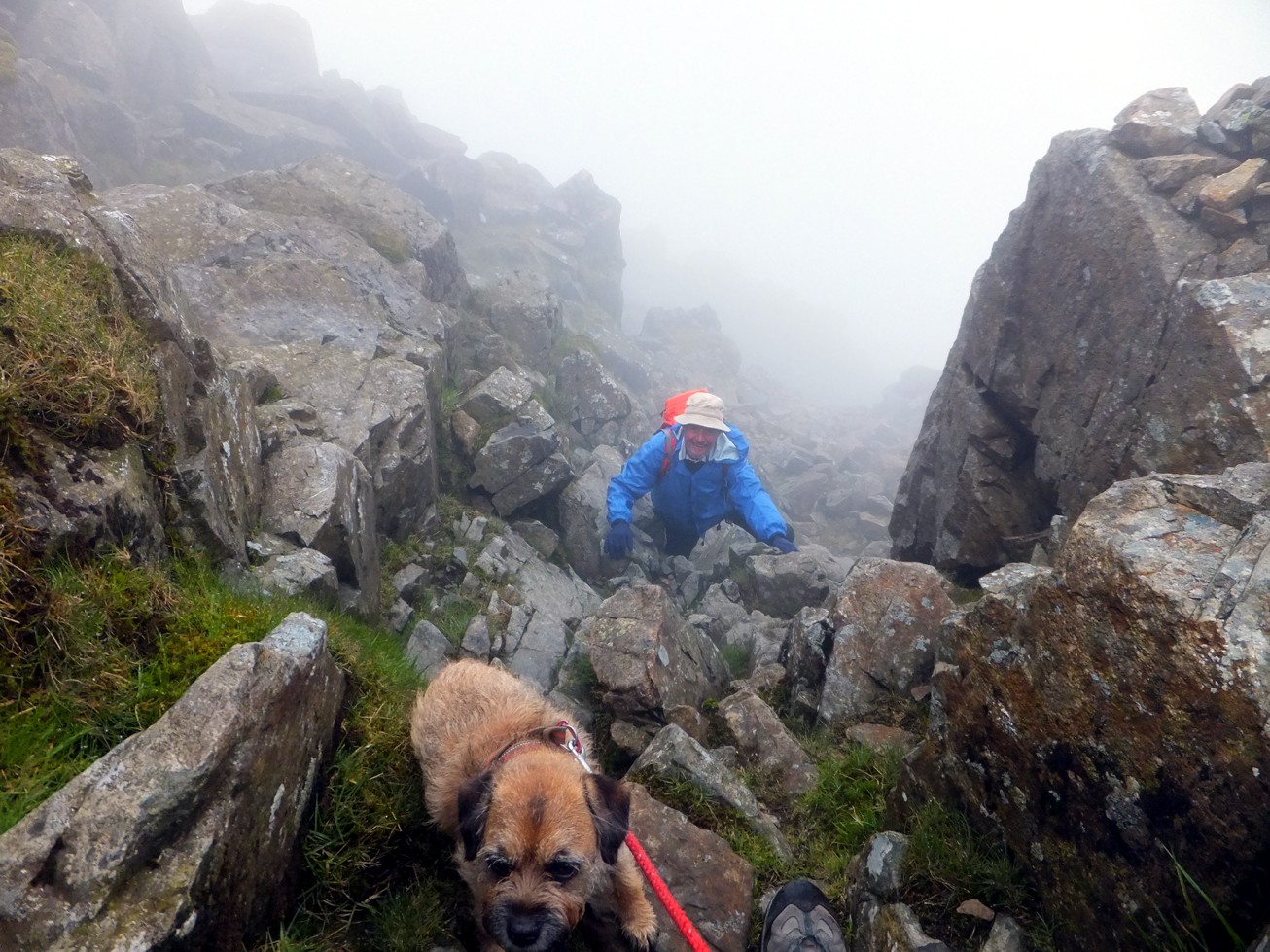
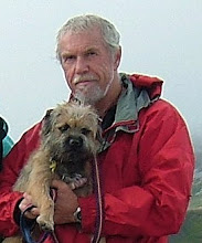
The track gives out and Pete and Bella are in the rough!


After taking a few shots of the sky and his shoes Pete managed this "selfie" up on Comb Height just as the path down the ridge ran out and left them in really rough going. The weather just got better and better though and then they found a path again and all was well with the world.


Mosedale from the lower slopes of Comb Height

Sunday 21 June 2015

Glyder Fawr 1001m

West face of Tryfan and Llyn Bochlwyd from Y Gribbin


On Monday 15/6, the first day of our Welsh trip, Pete, Lyn and Bella set off in fine weather from the Ogwen valley to climb Glyder Fawr 1001m by the rocky ridge of Y Gribbin. The picture is from the lower slopes of Y Gribbin with Llyn Bochlwyd below and Llyn Ogwen further beyond to the left. The west face of Tryfan 915m forms a backdrop to the scene.


Upper section of Y Gribbin.


The upper crags of Y Gribbin reared above us presenting a forbidding aspect as we climbed higher up the ridge, mist swirled in on us adding a touch of drama to the adventure.


Watery reflections of Y Gribbin 

Looking down Y Gribbin, Llyn Idwal far below


You can see the tiny pool of water where Pete caught the reflections of Y Gribbin far below here just to the right of the path. The mist thickened for a while as we picked our way carefully up the scree and tumbled boulders of the ridge.


Y Gribbin's upper rocky section

Bella having fun scrambling on Y Gribbin.


Mist clearing on Castell y Gwynt


As we topped out onto the summit plateau of Glyder Fawr the mist began to clear revealing the dramatic rock formation known as Castell y Gwynt or Castle of the Winds to the West, beyond which rose the boulder strewn summit of Glyder Fach 994m.


Pete and Bella on the summit of Glyder Fawr


Descent from Glyder Fawr

 
The descent from Glyder Fawr as far as the tiny lake of Llyn Cwn which lies in the col between Y Garn and Glyder Fawr was on unpleasant scree. After that the going improved and we descended into Cwm Idwal by a steep path to the west of the forbidding crags of the Devil's Kitchen.

Friday 5 June 2015

A windy recce of the Cumbrian Way route.

Coppermines Valley Coniston

Pete, Lyn, Bella and their old college mate Graham went down to Coniston on Tuesday to recce part of the Cumbrian Way route which they were unfamiliar with. The plan was to see if the path marked on the map from Levers Water up onto Swirl Hawse, between Wetherlam and Swirl How, actually existed or was it one of those rights of way that the OS mark so prominently by a green broken line that may or may not exist on the ground.


Mysterious constructions above Coppermines Valley

It was wet and the wind was increasing, but not too wet and windy to deter the intrepid quartet on their route finding quest. In addition they found an alternative way up to Levers Water from the one we followed last year.


The stone ramp below Kennel Crag

There was a stone-built ramp above the old mine workings in Red Dell, marked on the OS map by two parallel lines. We ascended it then followed a steep path to the top of Kennel Crag from where Levers Water is just a short distance beyond.


Levers Water from Kennel Crag

Levers Water looked grim, enclosed by mist with columns of spray whipped up by the wind, we decided that we would continue alongside the tarn to try and find the path to Swirl Hawse but we would not climb higher. The outlet of the lake (centre) was a raging torrent which we would not be able to cross today.


View across Levers Water to Black Sails, mist lifting.


The path we were looking for is marked on the map ascending the West flank of Black Sails above Swirl Hawse Beck. We discovered that the path does undoubtedly exist and though we didn't follow it far up the valley because of the wind we could clearly see it snaking up the fellside towards Swirl Hawse, which is the pronounced dip in the skyline in the photo above. We crossed swollen Swirl Hawse Beck with difficulty and completed a circuit of Levers Water then as we couldn't cross the outlet we descended into Boulder Valley, traversed across below Grey Crag and went on down to the YHA in Coppermines valley for tea.


Coppermines Valley YHA for tea and a bun.

Great Gable on Wednesday

Graham and Bella in action on Great Gable


On Wednesday Pete and Bella went out walking with Graham from Sydney, Australia, an old pal from art college days, who was staying with us for a few days. Our objective was Great Gable, a Classic, by a classic route... the NW ridge. We walked from Honister, the wind less of a problem than on the previous two days and the sky clear and bright. When we reached Beck Head we caught a brief glimpse of Wasdale before the mist closed in and stayed with us as we climbed the ridge, clearing only on the descent to Windy Gap. The photo shows Graham and Bella scrambling up the rocky ridge to the West of Gable Crag, it's Bella's favourite section of the route and Graham looks as if he's enjoying it too.